
Tuesday, May 4, 2021 From rOpenSci (https://ropensci.org/blog/2021/05/04/what-s-new-in-terrainr-0-4-0/). Except where otherwise noted, content on this site is licensed under the CC-BY license.
terrainr version 0.4.0 is now on CRAN! This version is a relatively minor update
that shouldn’t impact most workflows, but makes some changes to improve the
logic and consistency of the package. The rest of this post runs through the
changes you can expect if you update.packages any time soon!
🔗 What’s a terrainr?
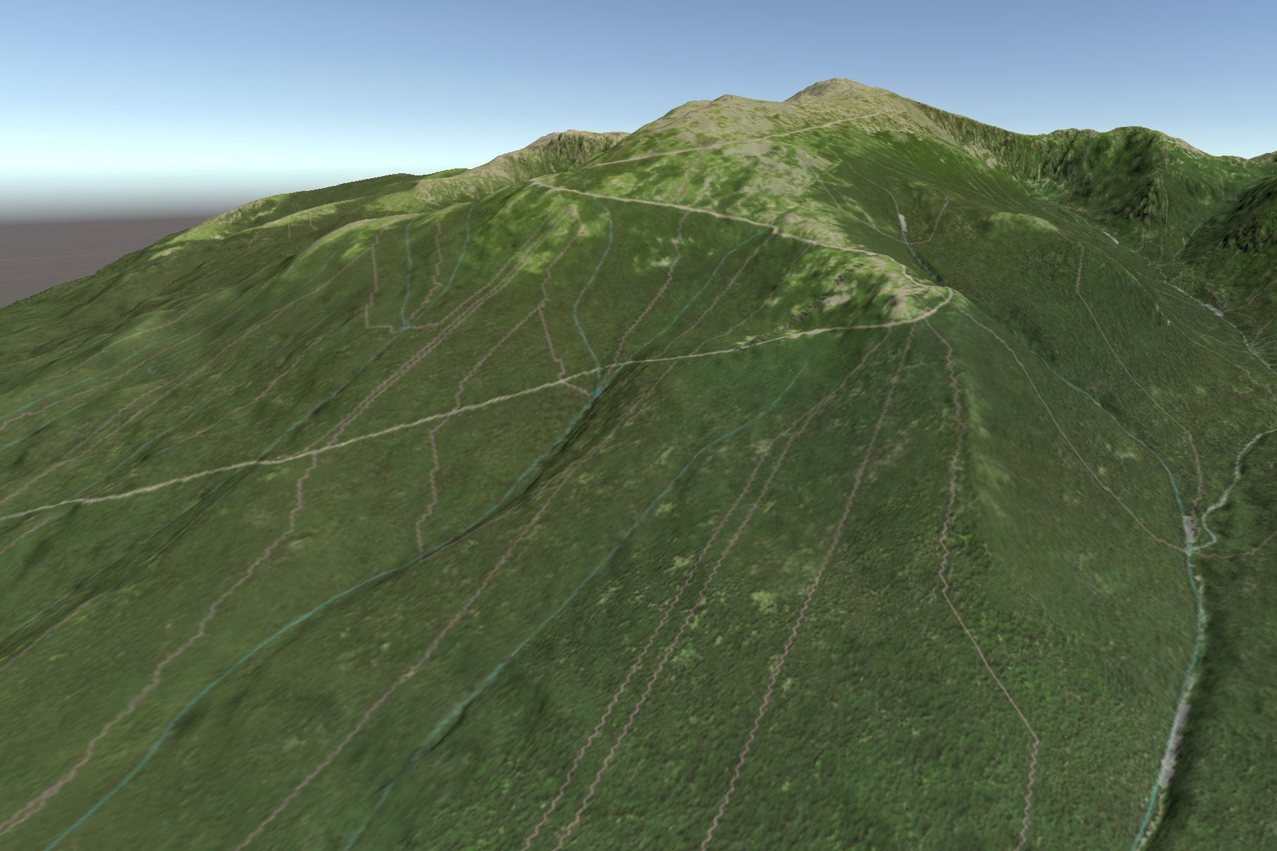
terrainr is an R package for the retrieval and visualization of spatial data. It provides functions to download elevation data and basemap tiles for points within the United States (using public domain data from the USGS National Map), visualize them in R via ggplot2, and process them for 3D visualization using the Unity 3D engine. You can see the docs and access the GitHub repo here!
terrainr is a recent addition to rOpenSci, passing through the peer-review process at the end of February. The package is a lot better for the comments from Mike Johnson and Sydney Foks during the review process, and I’m incredibly grateful for their contribution.
Now, as for what’s new in version 0.4.0:
🔗
merge_rasters can handle tiles with different numbers of bands
The old implementation of merge_rasters was very bulky, read all your map
tiles into memory at once, and was a bit of a mess to maintain thanks to the
large number of paths you could theoretically take through the code. The commit
(suggested via rOpenSci review!) replacing it with gdalwarp via sf is
probably the single best code improvement I’ve made to this package. Unfortunately,
the old method could also handle merging rasters with differing numbers of
bands, while the simple gdalwarp fix couldn’t.
So the old implementation is back as an internal method while I look for a
better solution to this problem. merge_rasters will now attempt to use
gdalwarp to merge your input files and then fall back to (a massively
simplified version of) the older version if gdalwarp fails.
As for why you’d want to automatically merge rasters with different numbers of bands, well…
🔗
get_tiles doesn’t auto-download transparency values for NAIP imagery
NAIP orthophotography provides fantastic continuous 1-meter images for the
continental United States. When downloading these photos with the argument
transparency = true, which used to be the default, most photos don’t have
any transparent pixels to talk about and as such are returned and saved as 3
band rasters (RGB images). Some photos, however, do have such pixels and are
returned with a 4th alpha band. This causes problems with gdalwarp as well as
image editing software, and the majority of the time users are not better served
by these pixels being transparent.
As a result, this version changes the default transparency argument for
get_tiles and hit_national_map_api to false when downloading NAIP images
(no other data source is impacted). This is one of the reasons this version
gets a 0.x.0 number – while it should be a small change, the same inputs to
functions no longer returns the same outputs (though I doubt people would
notice), so I’m counting this as a breaking change.
There’s a slightly more impactful breaking change worth noting though:
🔗 Functions pay attention to the provided CRS
This header is actually about two distinct changes.
First, another new behavior with get_tiles is that rather than assuming the
provided data and downloaded image should both be using the WGS84 CRS (EPSG
4326), get_tiles will now infer the EPSG CRS from any provided sf or
Raster object. If the numeric code is missing, this function will still assume
4326.
Similarly, rather than specifying target_crs in vector_to_overlay, this
function will now return an overlay projected to match reference_raster’s CRS.
Missing CRS are handled slightly differently here – if the error_crs argument
is NULL, this function will warn; if FALSE it will assume 4326, and if
TRUE it will interrupt the function with an error.
Those are the major changes to this iteration! On top of these there are some minor changes to the package internals, slowly removing dead code paths and simplifying things behind the scenes. If you have any problems (bugs or missing features) with the package, feel free to open an issue!
Filed under
Suggest an edit
Open a pull request
