
rOpenSci package or resource used*
What did you do?
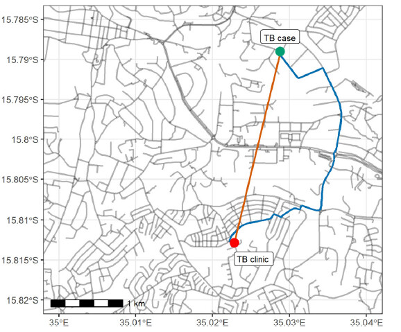
We estimated the distance from study participants’ (TB patients) households to their TB treatment initiation clinic using two approaches. The first approach was to estimate the distance based on a ‘straight line’ distance Cartesian distance. In the second approach, we used Blantyre urban road network downloaded from OpenStreetMap (OpenStreetMap Foundation) to calculate the shortest road network distance using the stplanr R package
URL or code snippet for your use case*
Image
Sector
Public health
Field(s) of application
epidemiology
If you reported this use case and want to modify or remove it, use the "Suggest an edit" link in the sidebar
to open a GitHub pull request, or contact us!