
rOpenSci package or resource used*
What did you do?
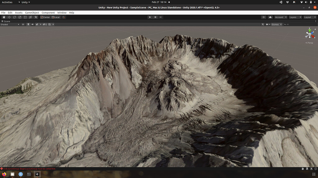
Visualized Mt. St. Helens in Unity, using public-domain data from the USGS entirely retrieved and pre-processed in R.
URL or code snippet for your use case*
library(terrainr)
library(sf)
library(progressr)
handlers("progress")

st_helens <- data.frame(
  lat = 46.1914,
  lng = -122.1956
)

st_helens <- st_as_sf(st_helens, coords = c("lng", "lat"))
st_helens <- st_set_crs(st_helens, 4326)
st_helens <- set_bbox_side_length(st_helens, 8000)

with_progress(
  output_tiles <- get_tiles(st_helens,
                            services = c("elevation", "ortho"))
)

merged_tiles <- vapply(output_tiles, merge_rasters, character(1))
mapply(
  function(x, y) raster_to_raw_tiles(x, "st_helens", raw = y),
  merged_tiles,
  c(TRUE, FALSE)
)
This gets you a set of files in the format that Unity expects. You still need to import them by hand (for now…) – see the Unity vignette for more on that!
Image
I’m only allowed to upload one image – the original tweet has a few more.
Sector
Other
Field(s) of application
ecology, geography
If you reported this use case and want to modify or remove it, use the "Suggest an edit" link in the sidebar
to open a GitHub pull request, or contact us!